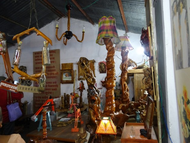
There are many stone age sites in Chandrapur District.Suresh Chopane,a renowned researcher found many stone age tools in the district, which has been displayed in his Rock Museum. Archeological finds such as signs of pottery making, suggest inhabitation of the Chandrapur area in
Neolithic times.
From ancient times, Chandrapur has fallen under the control of many different rulers. Between 322 BCE and 187 BCE, much of India, including Maharashtra, was part of the
Maurya Empire.From 187 BCE to 78 BCE, Chandrapur was part of the
Shunga Empire which controlled much of central and eastern India.The
Satavahana Empire controlled Chandrapur from the 1st century BCE to the 2nd century CE.The
Vakataka dynasty ruled from the area from the mid 3rd century CE to 550 CE.The
Kalachuri dynasty ruled in the area in the 6th and 7th centuries CE.The
Rashtrakuta dynasty followed, controlling the Chandrapur region between the 7th and 10th centuries. The
Chalukya dynasty ruled in the region to the 12th century CE.The
Seuna (Yadava) dynasty of Devagiri ruled a kingdom, including the Chandrapur area, in approximately 850 CE and continued until 1334 CE.
The Gond people are part of the
Adivasi (indigenous people) of India. In ancient times, the Gond diaspora spread throughout central India. After the passage of many kings, who were largely subservient to other rulers, the Gond king, Khandkya Ballal (1470 – 1495) came to the throne. He founded Chandrapur.
As per legends, Khandkya, who resided in
Sirpur was covered in tumours. His wise and beautiful wife nursed him. She asked him to leave Sirpur and move to the north bank of the
Wardha River. There, the king built a fort he named "Ballalpur" and thus founded city of
Ballarpur. One day, while hunting north-west of Ballalpur, the king became thirsty and rode up to the dry bed of the Jharpat river in search of water. He discovered water trickling from a hole, and after drinking, washed his face, hands and feet. That night he slept soundly for the first time in his life.
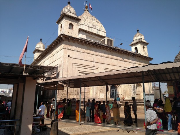
On his return the queen was delighted to see that many of the tumours on her husband's body had disappeared. The king said it was the water that had cured him and took his wife to see the water hole. On clearing the grass and sand, they found five footprints of a cow in the solid rock, each filled with water. The water source at the spot was inexhaustible and considered holy. The place was called "Tirtha of Acalesvar of the Treta Yuga". When the king bathed in the water all the tumours on his body vanished. That night at the water hole, Acalesvar appeared to the king in a dream, and spoke comforting words. A temple was built over the water hole.
One morning, at the water hole, the king saw a hare darting out of a bush and chasing his dog. Eventually, the dog killed the hare. The king found a white spot on the forehead of the hare. The queen said it was a good omen and a fortified city should he built with its layout based on the chase of the dog and hare. She said the place where the hare was killed would be unlucky for the city. The king's officers, the "Tel Thakurs" built the fortified city. The city became Chandrapur.
Gond rule was lost in 1751 to the
Maratha period. The last ruler of the Maratha dynasty,
Raghuji Bhonsle III died in 1853 without issue.

In 1853, Chandrapur was annexed to British India. During the British colonial period the area of Chandrapur was called "Chanda". By 1871,
Anglican and
Scottish Episcopal missionaries had arrived in the city.
[12] In 1874, three
tehsils were created: Viz Mul, Warora and Bramhpuri. The upper Godavai district of
Madras was abolished and four tehsils were added to Chandrapur to form one tehsil with
Sironcha, approximately 150 km to the south, as its centre of governance. In 1895, the headquarters was transferred to Chandrapur. In 1905, a new tehsil with headquarters at
Gadchiroli was created through the transfer of
zamindari estates from Bramhpuri and Chandrapur tehsil. In 1907, a small area of land was transferred from Chandrapur to the newer districts and another area of about 1560 km
2, comprising three divisions of the lower Sironcha tehsil (Cherla, Albak and Nugir) were transferred to Madras State. Between 1911 and 1955, no major changes occurred in the boundaries of the district or its tehsils.
Climate
Chandrapur has a hot and dry climate. December is the coldest month, with a minimum average temperature of 9 °C and a maximum average temperature of 23.2 °C. May is the hottest month with a mean maximum temperature of 43 °C and a mean minimum temperature of 28.2 °C. On 2 June 2007, there was a highest recorded temperature of 49 °C. On January 1899, there was a lowest recorded temperature of 2.8 °C.
The
monsoon season comes between June and September. Chandrapur's average annual rainfall is 1249.4 mm. The average number of rainy days is 59.2.
| hideClimate data for Chandrapur (1981–2010, extremes 1901–2012) |
|---|
| Month | Jan | Feb | Mar | Apr | May | Jun | Jul | Aug | Sep | Oct | Nov | Dec | Year |
|---|
| Record high °C (°F) | 35.8
(96.4) | 40.0
(104.0) | 44.4
(111.9) | 46.4
(115.5) | 48.3
(118.9) | 49.0
(120.2) | 40.6
(105.1) | 37.2
(99.0) | 38.4
(101.1) | 40.1
(104.2) | 36.1
(97.0) | 38.7
(101.7) | 49.0
(120.2) |
|---|
| Average high °C (°F) | 30.5
(86.9) | 33.4
(92.1) | 37.6
(99.7) | 41.3
(106.3) | 42.9
(109.2) | 38.0
(100.4) | 32.0
(89.6) | 30.8
(87.4) | 32.4
(90.3) | 32.7
(90.9) | 31.1
(88.0) | 29.9
(85.8) | 34.4
(93.9) |
|---|
| Average low °C (°F) | 14.8
(58.6) | 16.9
(62.4) | 21.1
(70.0) | 25.2
(77.4) | 28.0
(82.4) | 26.6
(79.9) | 24.4
(75.9) | 24.0
(75.2) | 24.0
(75.2) | 21.5
(70.7) | 16.8
(62.2) | 13.4
(56.1) | 21.4
(70.5) |
|---|
| Record low °C (°F) | 2.8
(37.0) | 3.9
(39.0) | 7.2
(45.0) | 11.7
(53.1) | 18.9
(66.0) | 20.0
(68.0) | 17.8
(64.0) | 18.3
(64.9) | 18.3
(64.9) | 10.9
(51.6) | 6.2
(43.2) | 3.5
(38.3) | 2.8
(37.0) |
|---|
| Average rainfall mm (inches) | 9.2
(0.36) | 12.8
(0.50) | 15.4
(0.61) | 17.1
(0.67) | 21.2
(0.83) | 202.8
(7.98) | 358.1
(14.10) | 363.7
(14.32) | 158.3
(6.23) | 73.1
(2.88) | 10.2
(0.40) | 6.2
(0.24) | 1,248.2
(49.14) |
|---|
| Average rainy days | 0.8 | 0.8 | 1.4 | 1.5 | 1.8 | 8.7 | 15.2 | 14.6 | 8.5 | 3.6 | 0.7 | 0.5 | 58.1 |
|---|
| Average relative humidity (%) (at 17:30 IST) | 44 | 34 | 27 | 22 | 23 | 48 | 70 | 75 | 68 | 60 | 53 | 48 | 48 |
|---|
|
Geography

Chandrapur is located in central India in the eastern part of Maharashtra state at 19.57°N latitude and 79.18°E longitude. Chandrapur is situated at 189.90 meters above the
mean sea level. The area of the city is about 70.02 km². The north-south length of the city is about 10.6 km, while the east-west length is about 7.6 km. The city slopes from the north to the south.
Chandrapur lies at the confluence of the Irai and Zarpat rivers. The Irai river has a history of flooding. Flood marks are seen on the walls of the city. In the north of the city, a dam is constructed on the river Erai, having the capacity of 207 million cubic meters. The Gaontideo Nala originates from the uplands of the
Chandrapur Super Thermal Power Station. The Macchhi Nala originates from uplands of Central Forest Rangers College.
Chandrapur lies on terrain rich in coal. Chandrapur is called a "geological museum" as there is a large variety of rocks as well as commercially valuable minerals and fossils. Samples of such rocks are collected at the Suresh Chopane Rock Museum.
Demographics
Per the 2011 census of India, Chandrapur's population was 375,000.
Languages
Marathi is spoken by majority of the people in Chandrapur. The native
Gondi is spoken by most of the
Gonds in Chandrapur.
Telugu is spoken by many Telugu people in Chandrapur. People can also speak
Hindi and
English.
In 2016, the inaugural All India Gondi Religious Convention was convened by the Central Provinces and Berar Gondwana Samaj Sewa Samiti in Warora, 30 km north west of Chandrapur. The Chair was Raja Virshah Krushnashah Atram, a descendant of Khandkya Ballal Sah and current titular Gond king of Chandrapur.
Religion
71.84 percent of people in Chandrapur are Hindu. 15.64 percent are Buddhist. 10.07 percent are Muslims; 0.94 percent are Christians; 0.54 percent follow Jainism; and 0.44 percent are Sikhs. 0.47 percent follow other religions and 0.05 percent identify with no particular religion.
Education
The
Karmavir Dadasaheb Kannamwar High School (previously known as the Zilha Parishad Jubilee High School) was established in 1906. The Lokmanya Tilak Vidyalaya was founded by
Bal Gangadhar Tilak. The Chanda Sikshan Prasarak Mandal is a large educational institution with a number of campuses in Chandrapur.
Important places
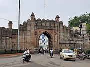
.Chandrapur Fort
.Mahakali Mandir
.Anchaleshwar Mandir
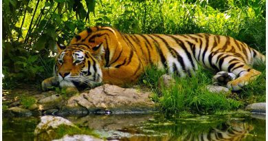
.Tadoba Andhari Tiger Reserve
Notable people
- Karmavir Dadasaheb Kannamwar, second Chief Minister of Maharashtra.
- Mohan Bhagwat, chief of the Rashtriya Swayamsewak Sangh.
- Shantaram Potdukhe, former Minister of Finance of Maharashtra.
- Barrister Rajabhau Khobragade, Deputy Chairman of Rajya Sabha, leader of the Republican Party of India (Khobragade) and follower of B. R. Ambedkar.
- Balasaheb Deshmukh, a follower of Bal Gangadhar Tilak. It was due to his efforts that Tilak visited Chandrapur and laid the foundation of Lokmanya Tilak Vidyalaya.
- Abdul Shafee, a politician of the Indian National Congress Party, Member of Parliament 5th Loksabha, MLC.
- Sudhir Mungantiwar Minister of Finance & Planning and Forests. Guadian minister of Wardha and Chandrapur2014 to 2019
- Mansi Burile, Dancer, Dhee Jodi 11 finalist, Dhee Champions contestant.
Must Visit Chandrapur!!!!!

